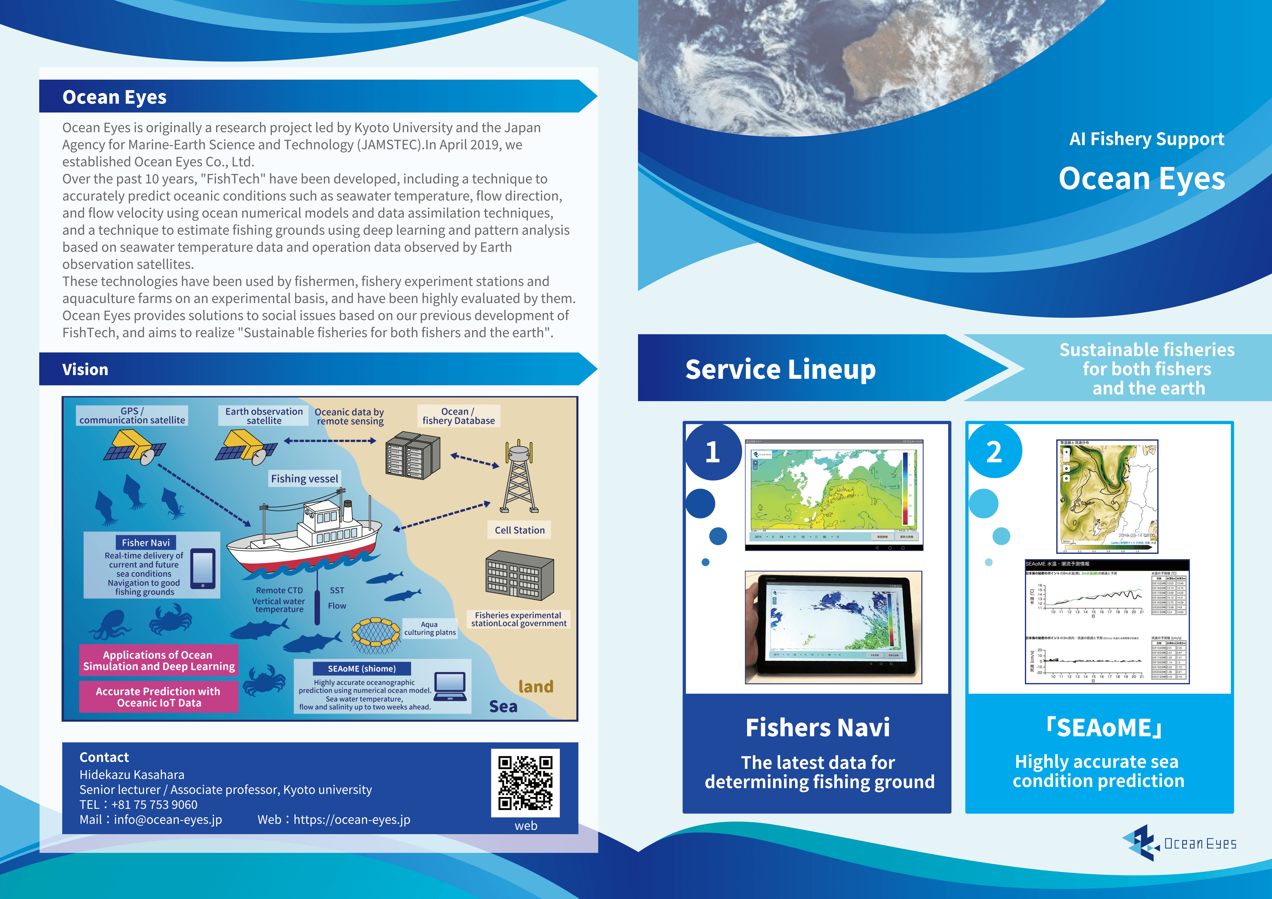
OceanEyes Service Overviews
We provide two FishTech services for fishing and marine industries.
- SEAoME : Highly accurate sea condition prediction system for each customers.
- Fishers Navi : Fishing ground determining support system.
Service brochures are here. Surface side. Back side.
SEAoME :State Estimate and Forecast of Marine Environments
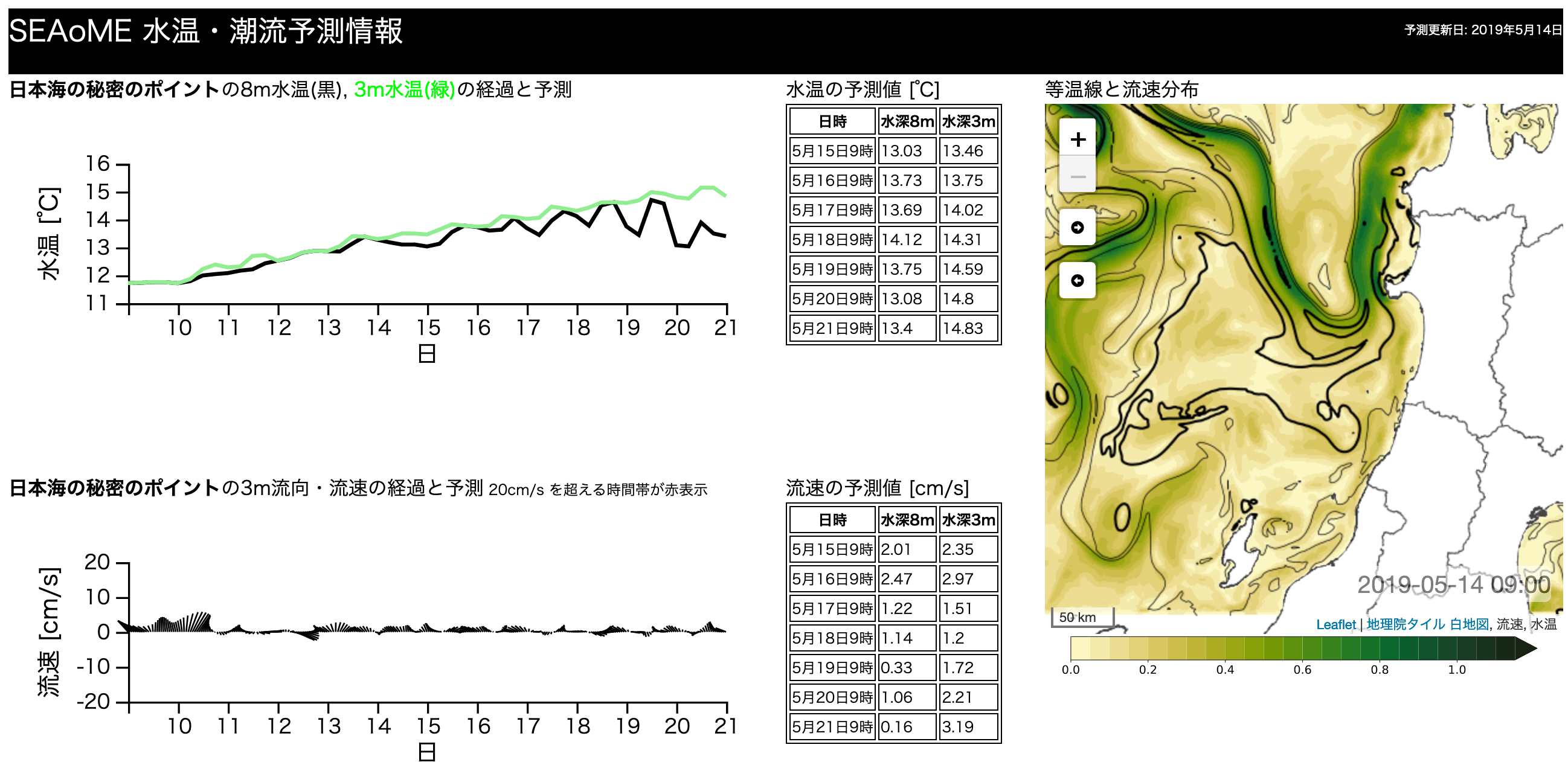
SEAoME_screenshot
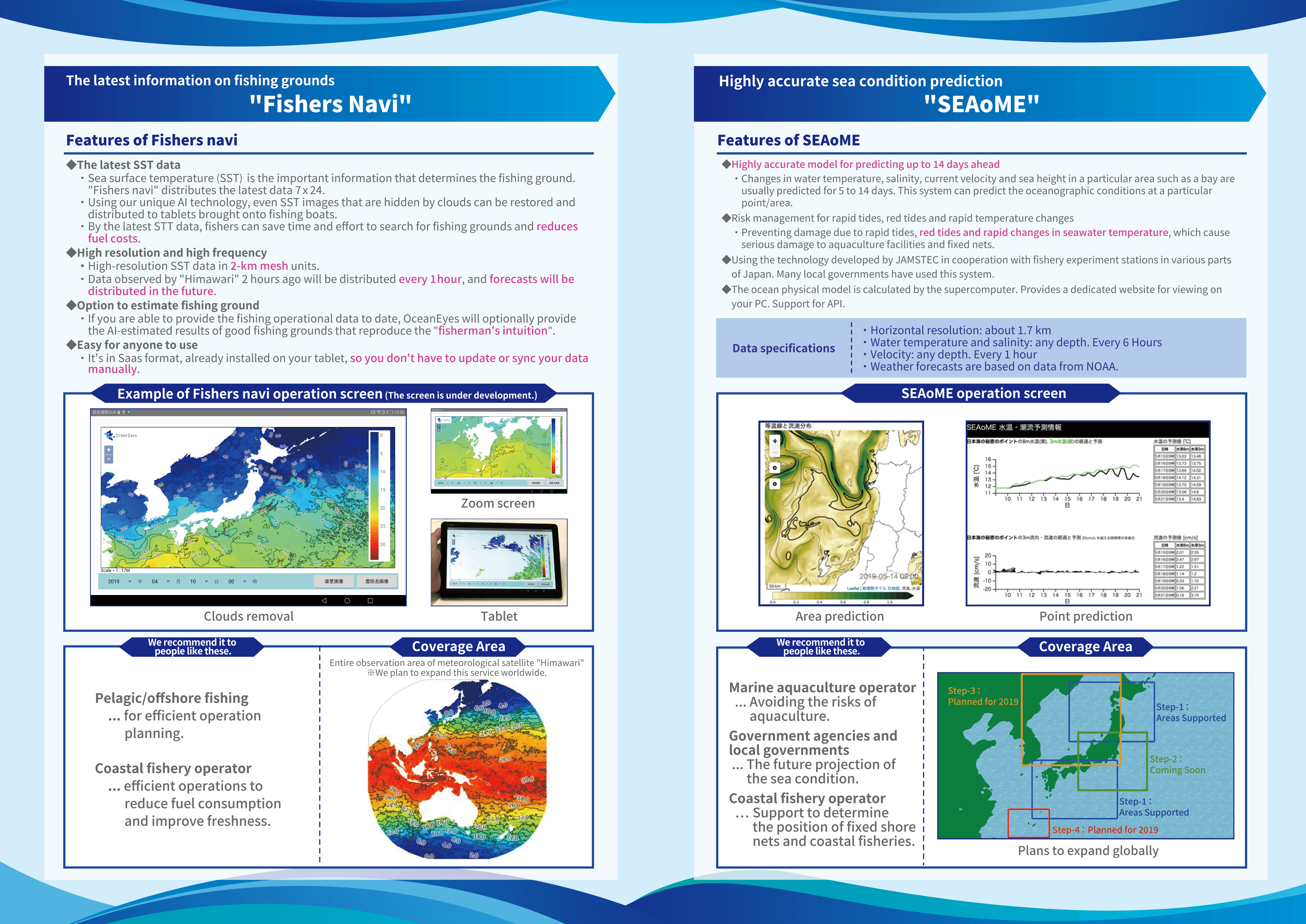
Features of SEAoME
Highly accurate model for predicting up to 14 days ahead
- Changes in water temperature, salinity, current velocity and sea height in a particular area such as a bay are usually predicted for 5 to 14 days.
Risk management for rapid tides, red tides and rapid temperature changes
- Preventing damage due to rapid tides, red tides and rapid changes in seawater temperature, which cause serious damage to aquaculture facilities and fixed nets.
Technology used in the field
- Using the technology developed by JAMSTEC in cooperation with fishery experiment stations in various parts of Japan.
- Many local governments have used this system.
The ocean physical model
- Calculated by the supercomputer.
- Provides a dedicated website for viewing on your PC.
- API support.
Data specifications
- Time range : 14 days ahead (maximum).
- Horizontal resolution: about 1.7 km
- Data provided and estimated intervals:
Water temperature and salinity: Any depth(36 layers). Every 6 Hours.
Velocity: any depth. Every 1 hour. - Weather forecasts such as wind and temperature are based on data from the National Oceanic and Atmospheric Administration (NOAA).
“Fishers Navi” contributing to productivity improvement of sea surface fishery
We will support the efficiency of fishery activities by providing frequent and highly accurate sea status information rather than what has been provided in the past. We predict the fishing ground by analyzing the water lifting data and the seawater temperature distribution for each operation point, support the decision of the fishing ground determined by experience and intuition, and navigate to the fishing ground.
FihersNai Screenshot. Cloud removal.
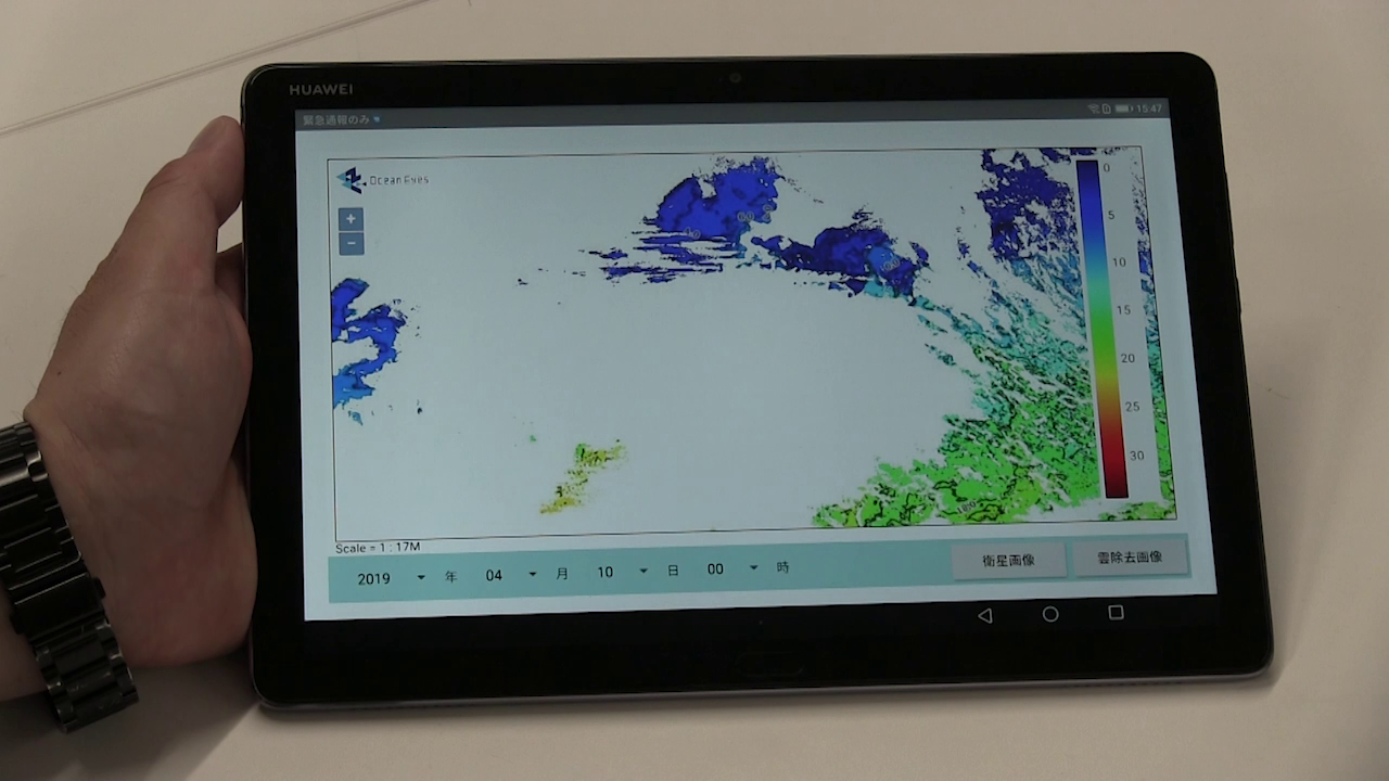
FishersNavi installed tablet.
Features of FishersNavi
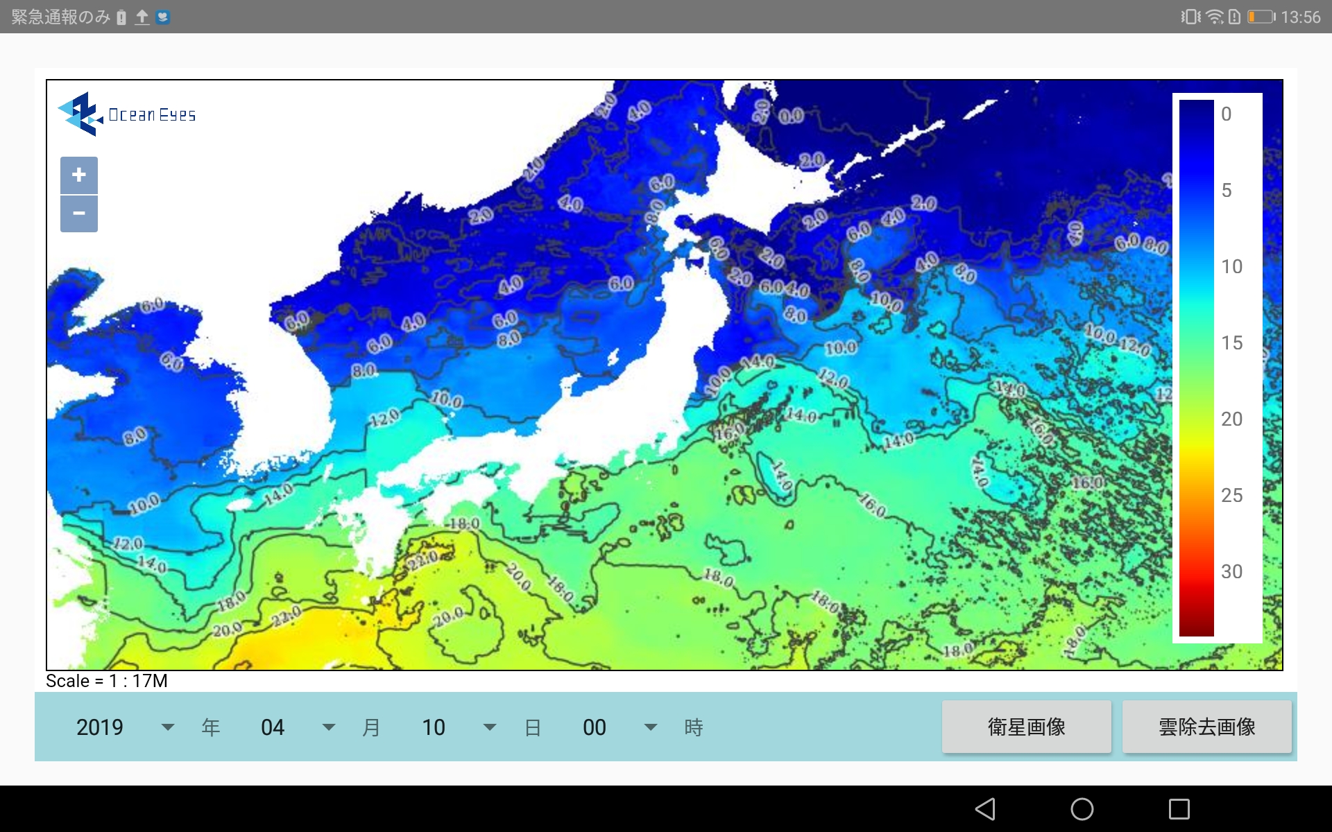
The latest SST data
- “sea surface temperature (SST) ” is the important information that determines the fishing ground. “Fishers navi” distributes the latest data 7 x 24.
- Using the OceanEyes’s unique AI technology, the latest data is generated from SST images taken by a meteorological satellite “Himawari” and distributed to tablets brought onto fishing boats.
- Fishers can determine fishing grounds based on the latest SST data, saving time and effort in searching for fishing grounds and reducing fuel costs.
High resolution and high frequency
- High-resolution SST data in 2-km mesh units.
- Data observed by “Himawari” 2 hours ago will be distributed every 1 hour, and forecasts will be distributed in the future.
Option to estimate fishing ground
- If you are able to provide the fishing operational data to date, OceanEyes will optionally provide the AI-estimated results of good fishing grounds that reproduce the “fisherman’s intuition”.
Easy for anyone to use
- It’s in SaaS format, already installed on your tablet, so you don’t have to update or sync your data manually.
Coverage Area
- Entire observation area of meteorological satellite “Himawari” (Western Pacific)
- We plan to expand this service worldwide.