When you understand the ocean “now,” fishing changes.
OEView — A sea condition information app that supports fishermen’s decision-making
The OEView App
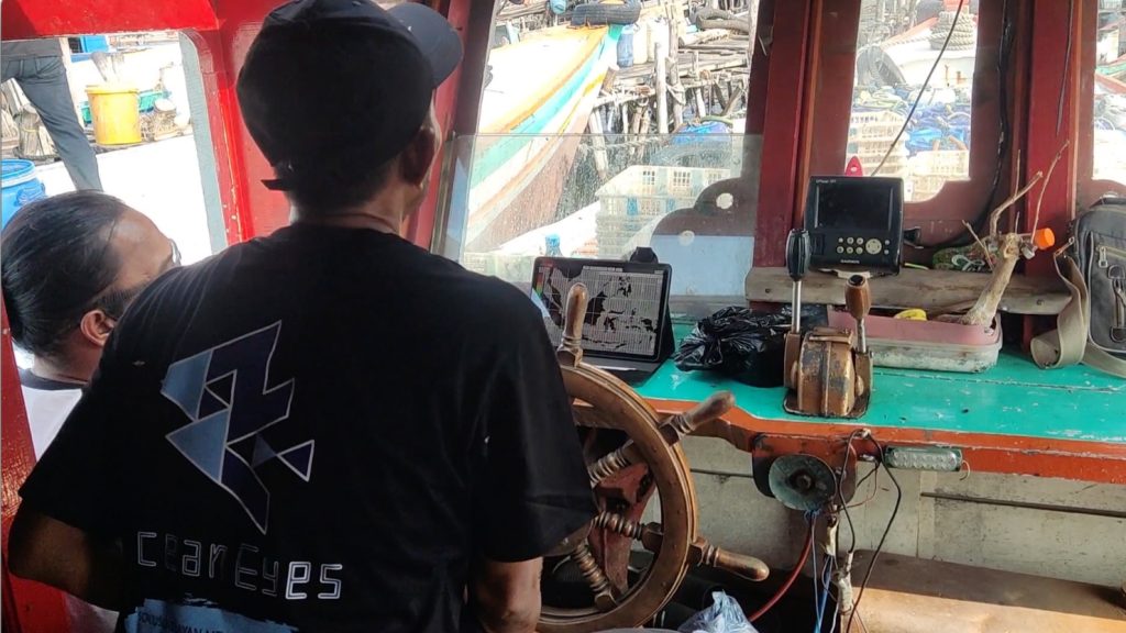
Even offshore, where mobile signals are unavailable, you can check the latest sea condition forecasts directly on your smartphone.
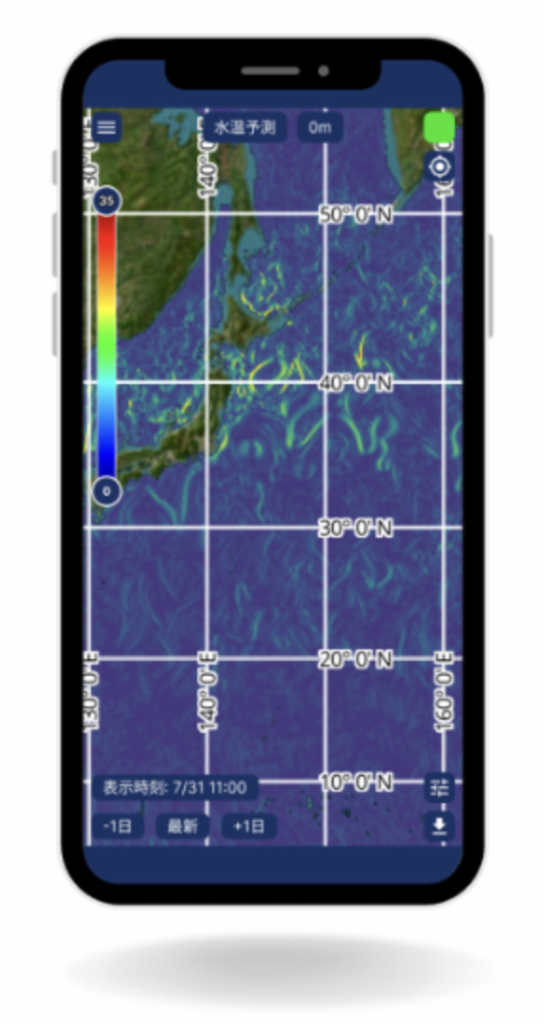
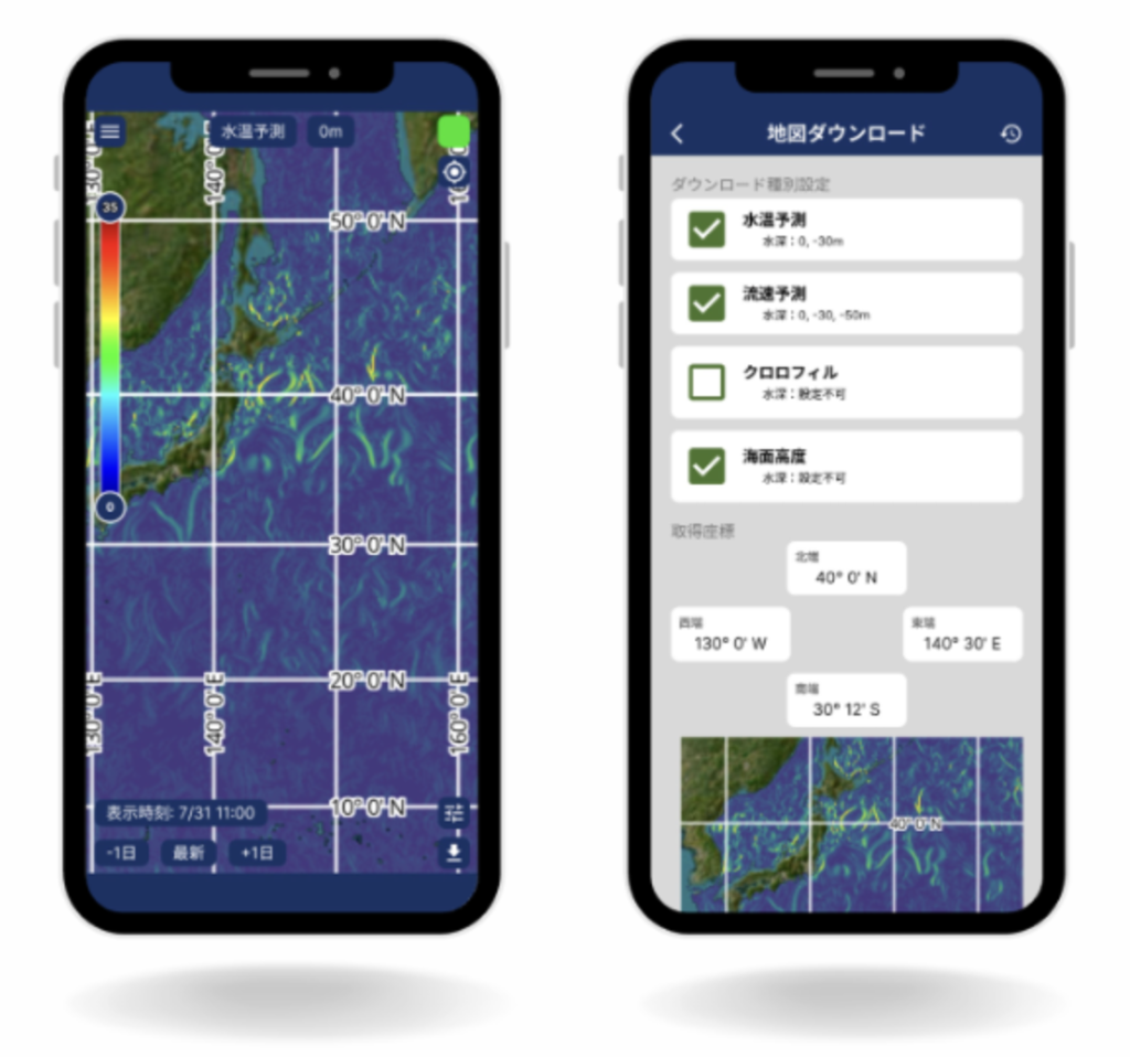
Key information such as water temperature, ocean currents, chlorophyll concentration, and wave conditions is all accessible in one app.
Download for Free Now
(iOS / Android)


The app is free to download and use.
What You Can Do with OEView
- Water temperature forecasts
- Current speed and ocean current forecasts
- Chlorophyll concentration
- Sea surface height
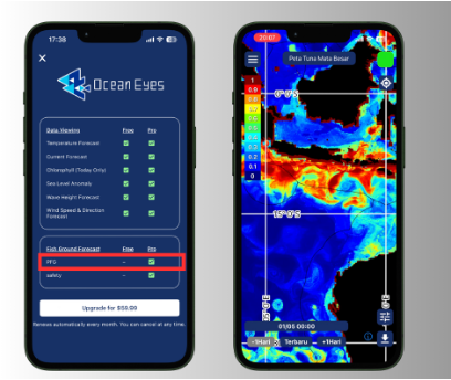
- New Bigeye Tuna Map (Note: Paid Version only)
- New Storm Map (Note: Paid Version only)
Note: Bigeye Tuna Map are currently available only in certain areas of the Southern Hemisphere.
They are not available in the Northern Hemisphere (including waters around Japan).
By combining this information, users can identify areas where fish are more likely to gather and better understand changes in sea conditions.
Useful in These Situations
- Check today’s sea conditions before heading out in the morning
- Use as a reference when deciding fishing grounds
- Predict fish movement and reduce unnecessary operation time
- Prepare safely even on rough sea days – Check hazardous areas in advance (Hazard Map)
- Identify areas where fish are more likely to gather and worth heading to (PFG: Potential Fishing Ground)
Available Offline
(No Signal Required)
“There’s no signal at sea…”
By downloading the necessary data in advance, OEView can be used without an internet connection.
Important fishing decisions are not affected by network availability.
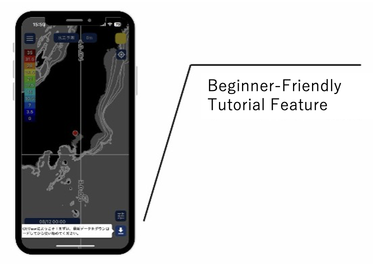
Easy to Use, Even for First-Time Users
Step-by-Step Tutorial Included
On-screen guidance walks you through each step, so you can use the app confidently from the start.
Simple and Intuitive Interface
Designed to be easy to operate, even for users new to smartphones.
Multilingual Support
Available in Japanese, English, and Indonesian.
Bigeye Tuna Map Feature
— Identify Areas Worth Going
Bigeye Tuna Map is a paid decision-support feature that highlights areas where fish are more likely to gather and where fishing is considered to have high potential value.
It is designed for users who wish to go beyond the sea condition data available in the free version and make more advanced, data-driven decisions.
※ This feature is currently available only in certain areas of the Southern Hemisphere.
※ It is not available in the Northern Hemisphere (including waters around Japan).
Who Is Bigeye Tuna Map For?
- Those who want to prioritize areas with higher fishing potential
- Those who aim to further improve operational efficiency
- Those who want to complement experience and intuition with data-based evidence
Storm Map Feature
— Assessing Ocean Safety
Beyond identifying where fish may be present, determining whether it is safe to go to a specific area is critically important for fishing operations.
Storm Map is a paid hazard map feature designed to help users identify areas that may pose potential risks.
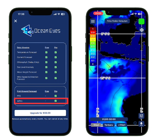
Based on sea condition data such as wind, waves, and ocean currents, the Storm Map feature visualizes areas that require caution and zones with higher risk directly on the map.
- Check areas to avoid before departure
- Use as a reference when making risk-avoidance decisions
- Support fishing ground and navigation decisions with safety as a priority
※ This feature does not guarantee safety and is intended to provide informational support for operational decisions.
※ This feature is currently available only in certain areas of the Southern Hemisphere.
※ It is not available in the Northern Hemisphere (including waters around Japan).
Download OEView for Free
The app is free to download and use.
Learn more about the technical data behind OEView (Technical Notes)